- Send money abroad quickly & easily with MoneyGram
- Transfer money through bank accounts & mobile wallets
- Simply sign up, select a receive & payment method
Nigeria weather by month
Check out Nigeria weather averages by month. Compare detailed monthly climate statistics including temperature, rainfall and sunshine figures.
| Jan | Feb | Mar | Apr | May | Jun | Jul | Aug | Sep | Oct | Nov | Dec | |
|---|---|---|---|---|---|---|---|---|---|---|---|---|
| Maximum daytime temperature °F |  91 91 |
 95 95 |
 95 95 |
 93 93 |
 88 88 |
 84 84 |
 82 82 |
 82 82 |
 84 84 |
 88 88 |
 90 90 |
 90 90 |
| Hours of sunshine (daily) | ||||||||||||
| Days with some rainfall |  0 0 |
 0 0 |
 2 2 |
 5 5 |
 10 10 |
 13 13 |
 15 15 |
 16 16 |
 15 15 |
 7 7 |
 0 0 |
 0 0 |
More about Nigeria
Nigeria by month
Jan Feb Mar Apr May Jun Jul Aug Sep Oct Nov Dec
Recommended for Nigeria
The climate guide for Nigeria (Abuja) shows long term monthly weather averages processed from data supplied by CRU (University of East Anglia), the Met Office & the Netherlands Meteorological Institute. Find out more about our data sources.
Top Nigeria destinations
Below are average maximum temperatures at popular countries, regions and places in Nigeria for next month - August. Select a destination to see the climate guide for all months of the year.
All Nigeria destinations
Metric (°C) | Imperial (°F)
Nigeria climate overview
With a coastline on the Gulf of Guinea and stretching north to the borders of the Sahara Desert, Nigeria is the most populous country by far in all of Africa. Like so many other modern African states, it was a creation of European imperialism, having been a British colony until 1960.
The northern border with Niger is semi-desert with little more than hardy scrub vegetation. Winters are dry, sunny and warm by day but cold at night. Strong Harmattan sandstorms are also possible in the dry winter months. After a very hot spring, the rainy season brings thunderstorms from May to September and temperatures fall a few degrees.
The dryness of the extreme north soon gives way to savannah and open woodland, which dominates the rest of northern Nigeria. The undulating landscape rises gently to the central Jos Plateau where large expanses of grassland prevail. Summer thunderstorms arrive in early May and continue until October, during which time temperatures are warm to hot. The drier winter season runs from November to April but at this time of year strong dusty winds plague the region.
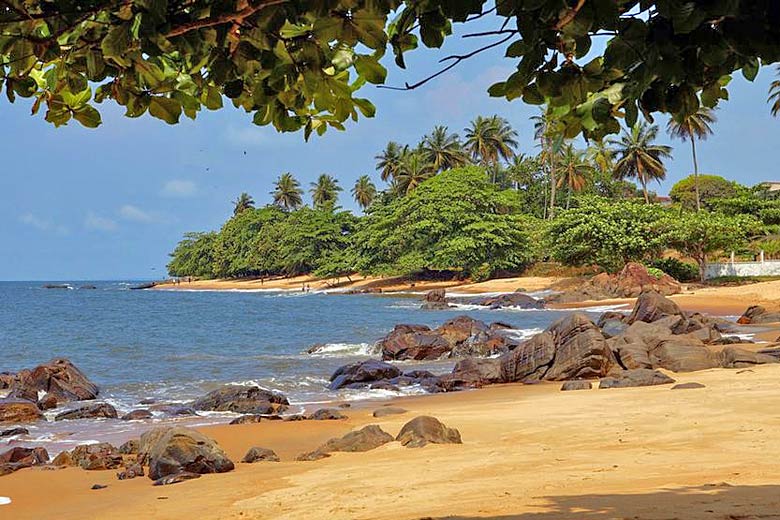
The southern half of Nigeria is much greener, as savannah grassland leads down to pockets of lush tropical rainforest towards the Gulf of Guinea coast. Forests also clad the spectacular Mambila Mountains that run along the Cameroon border. The Niger River meanders across the countryside, emptying into the Gulf via a marshy and mosquito infested delta. The coast itself is home to scenic sandy beaches and mangrove swamp.
Southern Nigeria is the country's wettest region with only a brief dry season from November to February. Thunderstorms are likely throughout the rest of the year but June and September are particularly wet. The warm or hot temperatures vary little and are accompanied by high summer humidity.
Compare Nigeria with the UK
Below the Nigeria chart shows average maximum daytime temperature for Nigeria (Abuja) and the UK (London).
Maximum daytime temperature (°F)
Metric (°C) | Imperial (°F)
Compare more Nigeria weather >>
Be inspired
Get your weekly fix of holiday inspiration from some of the world's best travel writers plus save on your next trip with the latest exclusive offers
We promise not to share your details
Related posts
Popular travel offers
Explore holidays in the sun for less
- Beach holidays
- Family holidays
- City breaks
- Summer holidays
- Winter sun holidays
- Holiday offers
- Top travel brands
- Airlines & flights
- Discount hotels
- Airport parking deals
- TUI
- Jet2holidays
- easyJet holidays
- Love Holidays
- January sales
Airport parking
- Manchester Airport
- Stansted Airport
- Bristol Airport
- Luton Airport
- Birmingham Airport
- Edinburgh Airport
- Gatwick Airport
- Glasgow Airport
- Newcastle Airport
Airport lounges
- Manchester Airport
- Birmingham Airport
- Bristol Airport
- Edinburgh Airport
- Glasgow Airport
- Heathrow Airport
- Newcastle Airport
- Stansted Airport
- Gatwick Airport


