


- Explore latest special offers & online deals from TUI
- Free child places & £0 deposits with direct debit available
- Book summer & winter sun holidays in 2026/2027
Mexico weather by month
Check out Mexico weather averages by month. Compare detailed monthly climate statistics including temperature, rainfall and sunshine figures.
| Jan | Feb | Mar | Apr | May | Jun | Jul | Aug | Sep | Oct | Nov | Dec | |
|---|---|---|---|---|---|---|---|---|---|---|---|---|
| Maximum daytime temperature °F |  72 72 |
 75 75 |
 79 79 |
81 |
81 |
77 |
75 |
75 |
73 |
73 |
73 |
72 |
| Hours of sunshine (daily) | ||||||||||||
| Days with some rainfall |  2 2 |
1 |
3 |
 6 6 |
 10 10 |
 15 15 |
 20 20 |
19 |
 16 16 |
 8 8 |
4 |
2 |
More about Mexico
Mexico by month
Jan Feb Mar Apr May Jun Jul Aug Sep Oct Nov Dec
Recommended for Mexico
 TUI deal finder
The climate guide for Mexico (Mexico City) shows long term monthly weather averages processed from data supplied by CRU (University of East Anglia), the Met Office & the Netherlands Meteorological Institute. Find out more about our data sources.
Mexico climate overview
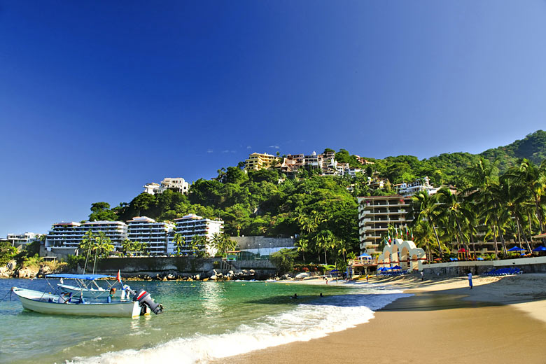
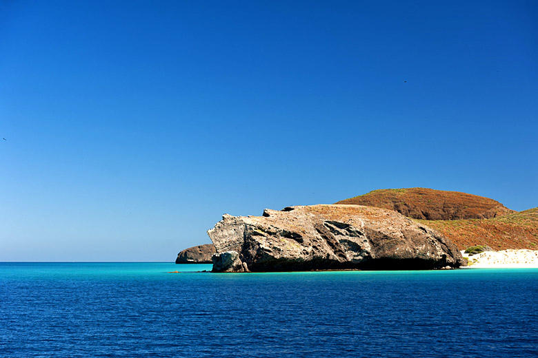
Mexico is a vast country with attractions that range from pre-Columbian ruins and grand colonial cities to white-sand beaches and glitzy resorts. It receives over 20 million visitors a year, most of them from the United States and Canada.
Its most distinctive geographical feature is the vast central plateau, flanked by mountains, that runs through the heart of the country from the border with the United States through almost two thirds of its length. At the southern end of the plateau near Mexico City there is a band of volcanoes running from east to west. About half a dozen are active, most notably Colima and Popocatepetl.
While the plateau itself is generally sparsely vegetated, forests of pine and oak dominate the mountains to the west. Throughout the south of the country, with its lower elevations, the vegetation is more typical of the tropics, and there are still some areas of undisturbed rainforest.
Generally Mexico has a tropical climate with wet summers and dry winters, however the north of the country sees little rainfall at any time while in Tabasco and southern Veracruz there is practically no dry season.
At the beginning of the wet season, towards the end of May, rain starts falling in the south of the country. It extends northwards almost all the way up the west coast by the end of July, and up the Gulf coast by the end of September, becoming progressively lighter further north and inland.
The rains moderate between September and November, remaining longer on the Gulf than the Pacific Coast. Since rain in Mexico tends to fall mainly at night, there are still usually at least 6 hours of sunshine each day in most beach resort areas such as , even at the height of the rainy season.
On the coastal plains, including Cancun on the Yucatan Peninsular, temperatures in the summer months are hot, and heat and humidity usually very high. However once on to the central plateau the high temperatures and heat and humidity disappear.
At the southern end of the plateau, for example around Mexico City, the warmest months are April and May, just before the rains begin. Daytime temperatures through the summer are warm but everywhere at high altitudes temperatures fall at night by as much as 15°C (27°F) in summer and by more in winter.
In the dry season heat and humidity moderates a little in the southern coastal regions, but temperatures still remain hot. Generally at this time of year it is far less cloudy and quite a bit warmer on the Pacific coast at places such as Ixtapa than on the Gulf and Caribbean coasts. On the plateau in the dry season it is still warm but at night temperatures drop sharply and frosts can occur.
Mexico is prone to hurricanes that may strike from either the Gulf of Mexico or the Pacific Ocean between June and November. It has also suffered some devastating earthquakes, most recently in 1985 when thousands died in Mexico City alone. The most active faults lie parallel to the south-west coast and stretch north-west into the Gulf of California, but when they strike, earthquakes can be felt far inland.
Top Mexico destinations
Below are average maximum temperatures at popular countries, regions and places in Mexico for next month - August. Select a destination to see the climate guide for all months of the year.
- Chichen Itza
- Merida
- San Jose del Cabo
- Cabo San Lucas
- Cancun
- Cozumel
- Playa del Carmen
- Puerto Vallarta
- Riviera Maya
- Tulum
- Acapulco
- Guadalajara
- Oaxaca
- Mexico City

All Mexico regions
All Mexico destinations
- Acapulco
- Akumal, Mexico - Caribbean Coast
- Cabo San Lucas
- Calakmul
- Cancun, Mexico - Caribbean Coast
- Cerocahui
- Chetumal
- Chichen Itza
- Chihuahua
- Ciudad Juarez
- Cozumel, Mexico - Caribbean Coast
- Culiacan
- Durango
- Guadalajara
- Huatulco
- Isla Mujeres, Mexico - Caribbean Coast
- Ixtapa
- Leon
- Los Mochis
- Manzanillo
- Mazatlan
- Merida
- Mexico City
- Mismaloya
- Monterrey
- Morelia
- Oaxaca
- Playa del Carmen, Mexico - Caribbean Coast
- Playa Paraiso, Mexico - Caribbean Coast
- Playacar, Mexico - Caribbean Coast
- Puebla
- Puerto Aventuras, Mexico - Caribbean Coast
- Puerto Morelos, Mexico - Caribbean Coast
- Puerto Vallarta
- Punta Mita
- Queretaro
- San Cristobal de las Casas
- San Jose del Cabo
- San Luis Potosi
- Tapachula
- Tijuana
- Torreon
- Tulum, Mexico - Caribbean Coast
- Uxmal
- Veracruz
- Xcaret, Mexico - Caribbean Coast
Mexico weather averages
Temperature in Mexico (°F)
| Jan | Feb | Mar | Apr | May | Jun | Jul | Aug | Sep | Oct | Nov | Dec | |
|---|---|---|---|---|---|---|---|---|---|---|---|---|
| Max temperature (daytime) | 72 |
75 |
79 |
81 |
81 |
77 |
75 |
75 |
73 |
73 |
73 |
72 |
| Min temperature (night-time) |  39 39 |
41 |
45 |
 48 48 |
50 |
 54 54 |
52 |
52 |
52 |
48 |
43 |
39 |
| Heat & Humidity |  0 0 |
0 |
 L L |
L |
L |
L |
0 |
0 |
0 |
0 |
0 |
0 |
Note: 0 = None, L = Low, M = Moderate, H = High, VH = Very high, E = Extreme
Sunshine & UV index in Mexico
| Jan | Feb | Mar | Apr | May | Jun | Jul | Aug | Sep | Oct | Nov | Dec | |
|---|---|---|---|---|---|---|---|---|---|---|---|---|
| Daily hours of sunshine | ||||||||||||
| Daily hours of daylight |  11 11 |
 12 12 |
12 |
 13 13 |
13 |
13 |
13 |
13 |
12 |
12 |
11 |
11 |
| UV Index (Maximum) |  9 9 |
 11 11 |
 11 11 |
11 |
11 |
11 |
11 |
11 |
11 |
11 |
10 |
8 |
Rainfall in Mexico
| Jan | Feb | Mar | Apr | May | Jun | Jul | Aug | Sep | Oct | Nov | Dec | |
|---|---|---|---|---|---|---|---|---|---|---|---|---|
| Number of days with some rain | 2 |
1 |
3 |
6 |
10 |
15 |
20 |
19 |
16 |
8 |
4 |
2 |
| Average monthly rainfall (inches) |  0.3 0.3 |
0.2 |
0.4 |
 0.9 0.9 |
 2.0 2.0 |
 4.3 4.3 |
 5.2 5.2 |
4.9 |
4.3 |
1.7 |
0.6 |
0.2 |
Tropical storm risk: Mexico hurricane season
% of month affected by tropical storms
Jan
Feb
Mar
Apr
May
Jun
Jul
Aug
Sep
Oct
Nov
Dec
Compare Mexico weather with the UK
The weather chart below compares the average monthly maximum daytime temperature for Mexico (Mexico City) and the UK (London).
Maximum daytime temperature (°F)
Mexico (Mexico City)
UK (London)
Jan
Feb
Mar
Apr
May
Jun
Jul
Aug
Sep
Oct
Nov
Dec
Metric (°C) | Imperial (°F)
More about Mexico

Be inspired
Get your weekly fix of holiday inspiration from some of the world's best travel writers plus save on your next trip with the latest exclusive offers
We promise not to share your details
Related posts


Popular travel offers
Explore holiday destinations
- Beach holidays
- City breaks
- Family holidays
- Half term holidays
- Spring holidays
- Summer holidays
- Autumn holidays
- Winter sun holidays
- Honeymoons
- Coolcations
- Compare places
- Ski resorts
Save with latest deals & discounts
- Holiday offers
- Top travel brands
- Airlines & flights
- Discount hotels
- TUI
- Jet2holidays
- Neilson
- Marella Cruises
- Holiday Extras
- Pierre & Vacances
- Caledonian Travel
- Club Med
Airport parking
- Manchester Airport
- Stansted Airport
- Bristol Airport
- Luton Airport
- Birmingham Airport
- Edinburgh Airport
- Gatwick Airport
- Glasgow Airport
- Newcastle Airport
Airport lounges
- Manchester Airport
- Birmingham Airport
- Bristol Airport
- Edinburgh Airport
- Glasgow Airport
- Heathrow Airport
- Newcastle Airport
- Stansted Airport
- Gatwick Airport