Tropical storm risk: hurricane seasons explained
We're on a mission to arm you with everything you never knew you wanted to know about tropical storm risk. Tropical storms, also known as tropical cyclones, can disrupt a well earned break; equally, you may find that your desired destination is relatively risk free.
- Tropical storm risk: interactive tool
- Using the tropical storm risk tool
- Understanding tropical storms
- What to expect during a tropical storm
- Storms that hit the headlines
From our interactive tool, which shows the percentage of each month that is normally affected by the passage of tropical storms, to understanding hurricane seasons and how storms form, you'll find everything you need to make an informed decision about travelling to storm-prone regions around the globe.
Tropical storm risk: interactive tool
Holidays are precious, and no one wants theirs ruined by a tropical storm, yet it can be very difficult to predict when and where they will occur. By analysing years of data, we have produced guides to illustrate where and when the risks are greatest.
To help you work out the tropical storm risk for your next holiday we have created this interactive tool, which clearly displays the percentage of each month that is normally affected by the passage of tropical storms.
Tropical storm risk
Using the tropical storm risk tool
Percentages can be tricky and somewhat misleading if they're misinterpreted. The percentages you can see above come from a thorough analysis of more than 60 years' worth of data. First, we looked at the position of all tropical storms every six hours from January 1951 to December 2010.
Then, using this information, we established the percentage of each month that is normally affected in destinations around the world where tropical storms occur. This is what you see on the chart.
Did you know? Tropical storms can quickly become very powerful with very high winds, heavy rain, and storm clouds that can reach nearly 60,000 ft above sea level - that's around twice the cruising altitude of a commercial aircraft
Crucially, our average percentages reflect the number of storm affected days; that's to say, days when the weather is in some way affected by a storm within 350 km, not necessarily days which are fully disrupted or at risk of a direct hit from a tropical storm, even during the height of the storm season.
Tropical storm risk: Cancun, Mexico hurricane season
The chart does, however, clearly show the peak hurricane, typhoon or cyclone season in an applicable destination when your overall risk of encountering a tropical storm is higher. And of course, if you are not present for every day of the month your chance of encountering a tropical storm will be significantly less.
Understanding tropical storms
A tropical storm is a very active area of low pressure that forms over a warm ocean in the tropics where conditions are likely to produce a tightly rotating system of clouds with high wind speeds and lots of rain.
Once winds reach a sustained 39 mph (34 knots) the low pressure system is classified as a storm and usually given a name. These storms are then very carefully monitored by the world's meteorological agencies as they have the potential to become even more powerful and cause a lot of damage.
Did you know? Between 80 and 100 tropical storms develop worldwide in a year, although fewer than half of these make hurricane/typhoon status
Conditions have to be just right for a tropical storm to form. A growing system can easily be blown apart if the winds at high altitude are too strong, while the sea temperature has to be warm enough to fuel its growth, at least 27°C.
Tropical storms never form on or near to the equator as they can't generate enough circular motion to whip up the wind speed, so they usually form between 5° to 10° north or south of this line.
Did you know? The direction a tropical storm spins is determined by the rotation of the earth, which is why tropical storms rotate counterclockwise north of the equator and clockwise south of the equator
Tropical storms need ideal conditions not only to form but to thrive. As a tropical storm takes its energy from warm water, it can quickly dissipate when it hits cooler sea temperatures or makes landfall, which is why the highest tropical storm risk for people is in or around coastal areas. The average size of a tropical storm is somewhere between 200 and 400 miles across.
Tropical storm risk: Miami, Florida hurricane season
The wording, 'tropical storm', relates to a variety of other commonly used terms to describe storms around the world including cyclones, hurricanes, and typhoons. Just to confuse things even more, a tropical storm is only upgraded to a hurricane or typhoon when the wind speeds exceed 74 mph (64 knots).
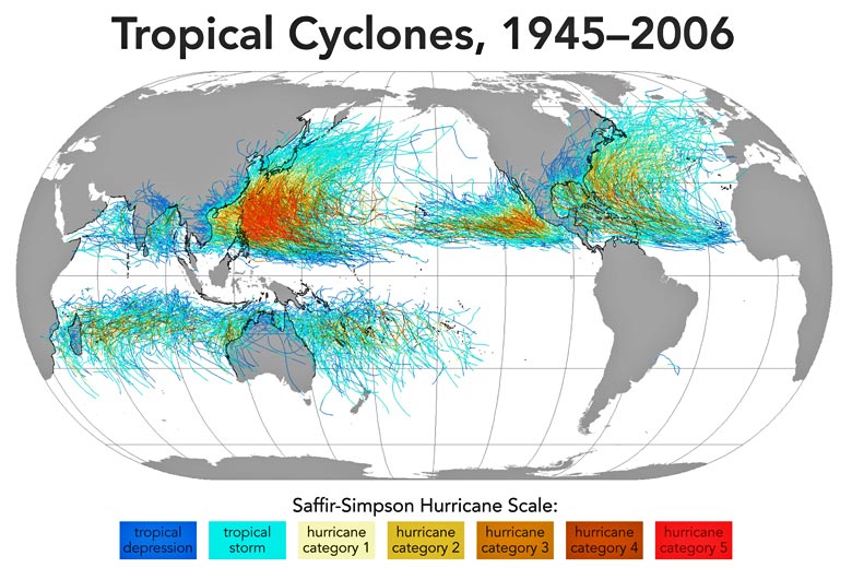
Where is the tropical storm risk high?
The role warm sea temperatures play forming tropical storms limits where you are likely to encounter them. Typically, destinations across the Caribbean, USA (the eastern coast in particular), Far East (notably the Philippines and Taiwan), and parts of the southern Indian Ocean such as Mauritius are most at risk of tropical storms. There are also many islands in the South Pacific which are threatened by seasonal tropical storms.
Tropical storm risk: Mauritius cyclone season
Then there are areas which you might think have a high tropical storm risk but actually get off quite lightly. You might be surprised to learn that most of Indonesia, including the ever popular island of Bali, is a low risk destination, as well as Singapore, the Maldives, Seychelles, Kenyan Coast, and even Sri Lanka. This is because they are all too close to the equator.
Tropical storm risk: Bali, Indonesia cyclone season
When is the tropical storm risk high?
The tropical storm risk is highest in late summer when the oceans are at their warmest and the sun is still strong enough to cause high levels of evaporation. During this time, storms generate frequently, and they can be incredibly big and strong, which makes them so dangerous at this time.
Did you know? A tropical storm can generate two hundred times the energy of all the power stations in the world combined
It's also worth noting that late summer applies, roughly speaking from late August to the end of September in the northern hemisphere, and from mid-February to early March in the southern hemisphere. In the north Indian Ocean, there are two peaks, one in May and another in October.
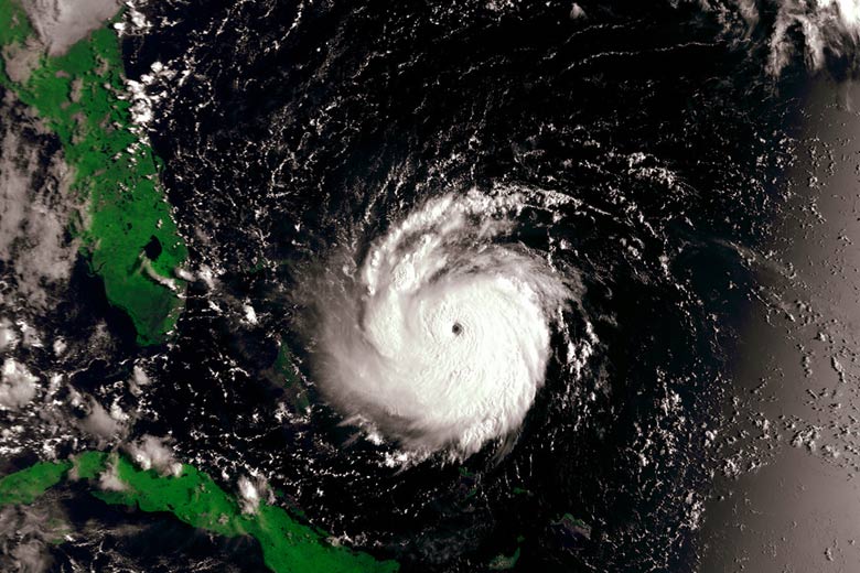
If you're planning a holiday and trying to work out your tropical storm risk, you will need to know when the storm season begins and ends in the area you are visiting. Tropical storm seasons around the world are as follows:
- North Atlantic Ocean (Caribbean & North America) - June to December
- Northeast Pacific Ocean (Mexico to Hawaii) - May to November
- Northwest Pacific Ocean (Philippines to Japan) - all year but mainly June to December
- North Indian Ocean (Bay of Bengal & Arabian Sea) - April to December
- South Indian Ocean (Australia to Mozambique) - October to May
- Southwest Pacific Ocean (South Pacific Islands to Australia) - October to May
What to expect during a tropical storm
Conditions you could expect during a tropical storm vary depending on your location, however, there are some general things to look out for when the tropical storm risk is high.
When a storm is within 350 km
More often than not, any encounter you have with a tropical storm is likely to be from a distance and not from a direct hit. If so, you could expect to be affected for anything from one to three days, depending on its intensity and proximity.
The same applies to the severity of the conditions you'll experience, as this is based on where you're located in relation to the storm's epicentre, as well as its size and strength. As a general rule you can expect the following:
- a lot of heavy rain
- thick cloud, overcast skies
- rougher seas, which can persist even after the storm has passed
- murky water as the sea is churned up
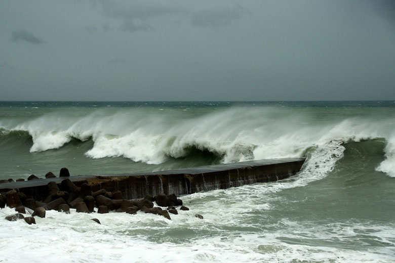
While there may be an increase in wind speed, it's unlikely to reach storm force (48-55 knots / 55-63 mph) unless the centre of the storm is within 50 to 100 km. It's worth taking care when out and about in case of fallen trees or landslides from the heavy rain, and you could also find that shops and businesses close if the tropical storm risk is severe. Always check local news for updates about the strength and position of any threatening passing storm.
Did you know? If the eye of a storm passes over you, there will be a lull before the winds and rain resume blowing from the opposite direction
When a storm is close or a direct hit
Although finding yourself directly in the path of a tropical storm is unlikely, it is indeed a very different picture, as the risk increases greatly. As well as the tropical storm risks associated with the weather mentioned above, you can also expect the following:
- far stronger winds, potentially in excess of 100 mph
- much more heavy rainfall
- thicker clouds and grey skies
- turbulent sea with strong rip currents and waves that make it exceptionally dangerous
- flooding caused by storm surge especially if it coincides with high tide
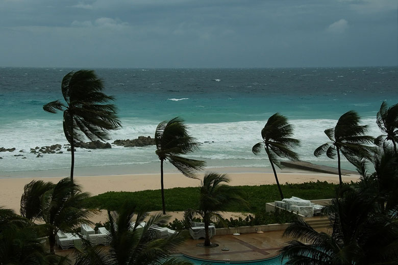
If you find yourself in the midst of a tropical storm, take precautions by staying indoors and away from large windows which are liable to break. Watch out for flying debris and flash flooding, and drink bottled water until you're sure that the main supply has not been contaminated.
You may encounter a blackout or some interference with the electricity supply. If the eye of a storm passes over, you're likely to be housebound for around six to eight hours.
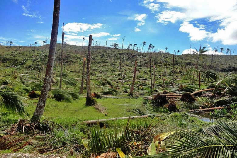
Storms that hit the headlines
Glimpsing briefly into the past, we can see that three major tropical storms occurred in the past 50 years which broke records for their sheer power, strength of the wind and volume of rainfall. These were:
- Most powerful - Super Typhoon Tip, Japan and some islands in the Western Pacific, October 1979: the largest tropical storm with the lowest air pressure ever recorded at over 2,000 km across, that's about half the size of the USA
- Strongest winds - Cyclone Olivia, Western Australia, April 1996: a top wind speed of 253 mph (220 knots) was recorded on Barrow Island, around 30 miles from the mainland
- Most rainfall - Cyclone Denise, Reunion, January 1966: in one 24 hour period, a record 1,825 mm (71.8 inches) of rain fell on the Indian Ocean island
While our tropical storm risk tool lets you see the percentage of each month that is normally affected by the passage of tropical storms on your travels, the fact remains that tropical storms can, and do, pop up at irregular intervals.
As anyone who tries to keep up with day-to-day conditions in the UK knows, the weather is ever-changing and evolving, which can make predicting it tricky, no matter how much historical data you have.
Tropical storm risk: Boracay, Philippines typhoon season
To give you an idea of how much the tropical storm risk can vary, between 2009 and 2018, the United States was hit by 10 hurricanes and 18 tropical storms. In four of those years, there were no hurricanes and only six tropical storms made landfall in the US but in 2017 there were three major hurricanes, the first for 12 years, and three tropical storms.
Tropical storm risk: New Orleans, Louisiana hurricane season
What does this tell us? If you're heading somewhere which is prone to tropical storms there is a chance you may come into contact with one, and our guide is here to help you decide whether the tropical storm risk at your chosen destination is one worth taking.
Be inspired
Get your weekly fix of holiday inspiration from some of the world's best travel writers plus save on your next trip with the latest exclusive offers
We promise not to share your details
Explore holidays in the sun for less
- Beach holidays
- Family holidays
- City breaks
- Summer holidays
- Winter sun holidays
- Holiday offers
- Top travel brands
- Airlines & flights
- Discount hotels
- Airport parking deals
- TUI
- Jet2holidays
- easyJet holidays
- Love Holidays
- January sales
Airport parking
- Manchester Airport
- Stansted Airport
- Bristol Airport
- Luton Airport
- Birmingham Airport
- Edinburgh Airport
- Gatwick Airport
- Glasgow Airport
- Newcastle Airport
Airport lounges
- Manchester Airport
- Birmingham Airport
- Bristol Airport
- Edinburgh Airport
- Glasgow Airport
- Heathrow Airport
- Newcastle Airport
- Stansted Airport
- Gatwick Airport


