


- Compare car hire prices to find best deal online
- Book flexible bookings with free cancellation policy
- No hidden fees + price match guarantee
New Zealand weather by month
Check out New Zealand weather averages by month. Compare detailed monthly climate statistics including temperature, rainfall and sunshine figures.
| Jan | Feb | Mar | Apr | May | Jun | Jul | Aug | Sep | Oct | Nov | Dec | |
|---|---|---|---|---|---|---|---|---|---|---|---|---|
| Maximum daytime temperature °C | ||||||||||||
| Hours of sunshine (daily) | ||||||||||||
| Days with some rainfall | ||||||||||||
| Sea temperature °C |
More about New Zealand
New Zealand by month
Jan Feb Mar Apr May Jun Jul Aug Sep Oct Nov Dec
Recommended for New Zealand
The climate guide for New Zealand (Wellington) shows long term monthly weather averages processed from data supplied by CRU (University of East Anglia), the Met Office & the Netherlands Meteorological Institute. Find out more about our data sources.
Top New Zealand destinations
Below are average maximum temperatures at popular destinations in New Zealand for next month - May. Select a destination to see the climate guide for all months of the year.
All New Zealand destinations
- Auckland
- Chatham Island
- Christchurch
- Dunedin
- Franz Josef
- Kaikoura
- Lake Tekapo
- Milford Sound
- Napier
- Nelson
- New Plymouth
- Paihia
- Queenstown
- Rotorua
- Taupo
- Tauranga
- Wellington
Metric (°C / mm) | Imperial (°F / inches)
New Zealand climate overview
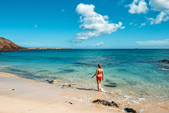
New Zealand is a popular holiday destination despite its remote location. Its main attraction is the natural beauty of its landscape, which ranges from precipitous fjords and snow-capped mountains in the South Island, to pristine white sand beaches and volcanoes in the North Island. The country is thinly populated with only about 4 million inhabitants, most of who live in the three largest cities of Auckland, Wellington and Christchurch.
New Zealand's two main islands lie about 2,000 kilometres (1,250 miles) to the south east of Australia. They cover an area slightly larger than the United Kingdom with a large mountain range running the length of the country from south west to north east. The highest mountains are all found in the Southern Alps of the South Island with about 20 peaks over 3,000 metres (9,850 ft).
The South Island is larger and more rugged than the North Island. With the exception of the wine growing areas in the far north, it is generally most suited to sheep grazing and arable farming. By contrast the North Island is more intensely farmed with a greater variety of crops that include avocados and kiwifruit. It also has by far the greatest concentration of dairy herds, the country's largest export earner.
Generally there is substantial rainfall in all months over most of the country apart from central eastern regions of the South Island. This is because New Zealand lies in the path of prevailing westerly winds that bring moisture-laden air off the Tasman Sea to western facing shores and slopes, especially on the South Island with its high mountain ranges.
The Maori name for the country, ''Aotearoa'', which loosely translates as ''Land of the Long White Cloud'', is indicative of the climate. Daily hours of sunshine are lower than at most destinations in Australia. However almost all of New Zealand compares favourably with Northern Europe in summer and New Zealand also has far more sunshine during its winter months than Northern Europe.
The sunniest regions are in the north of the South Island around Nelson and Marlborough, and on the north-east shoulder of the North Island to the north of Napier, both big wine-growing areas.
Levels of UV are particularly high during the summer months from December to March. This is partly due to depleted levels of ozone in the Southern Hemisphere, but also because of the low levels of air pollution throughout the country.
The sea surrounding New Zealand moderates temperatures in most coastal areas which means it never gets too hot in summer or too cold in winter. In Auckland, in the north of the North island, maximum daytime temperatures usually only reach 24°C (74°F) at the height of summer in February. While in Christchurch in the South Island night-time temperatures normally fall to a chilly 2°C (36°F) in the winter months of June and July.
In the South Island winters can be very cold at high elevations such as on Lake Tekapo, which is over 700 metres (2,300ft) above sea level, where temperatures fall below zero almost every night in June, July and August. The South Island is also subject to heavy snowfalls from time to time.
Strong winds are a feature of the Cook Strait that separates the two islands, as winds are channelled through, making the capital city of Wellington on the North Island one of the world's windiest cities.
New Zealand lies on an active fault where the Australian and Pacific plates meet and about 200 earthquakes occur every year that are large enough to be felt. The risk is highest in the North Island particularly along the east coast from Wellington to East Cape.
Compare New Zealand with the USA
Below the New Zealand chart shows average maximum daytime temperature for New Zealand (Wellington) and the USA (Washington).
Maximum daytime temperature (°C)
New Zealand (Wellington)
USA (Washington)
Jan
Feb
Mar
Apr
May
Jun
Jul
Aug
Sep
Oct
Nov
Dec
Metric (°C / mm) | Imperial (°F / inches)
Compare more New Zealand weather >>
Be inspired
Get your weekly fix of holiday inspiration from some of the world's best travel writers plus save on your next trip with the latest exclusive offers
We promise not to share your details
Related posts

Popular travel offers


Explore holidays in the sun for less
- Beach holidays
- Family holidays
- City breaks
- Summer holidays
- Winter sun holidays
- Holiday offers
- Top travel brands
- Airlines & flights
- Discount hotels
- Airport parking deals
- TUI
- Jet2holidays
- easyJet holidays
- Love Holidays
- British Airways
Airport parking
- Manchester Airport
- Stansted Airport
- Bristol Airport
- Luton Airport
- Birmingham Airport
- Edinburgh Airport
- Gatwick Airport
- Glasgow Airport
- Newcastle Airport
Airport lounges
- Manchester Airport
- Birmingham Airport
- Bristol Airport
- Edinburgh Airport
- Glasgow Airport
- Heathrow Airport
- Newcastle Airport
- Stansted Airport
- Gatwick Airport